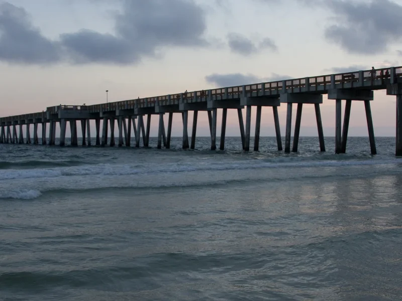

Beach time in Panama City Beach can mean a straightforward walk from a public access point, a day among dunes and pines, or a journey toward an undeveloped island. The water may link these places visually, but their access, facilities, and planning needs differ. Choose the setting first, then check what that particular outing requires.
The area also has nature away from the surf. Lake edges, old timber buildings, wetlands, and boardwalks give a visit a different scale. You can enjoy that contrast without treating every park as another place to swim.

Shell Island Snorkel and Dolphin Catamaran Cruise with Island Time
Experience the best of Panama City Beach on this 3-hour Shell Island snorkel and dolphin cruise aboard a spacious sailing catamaran. This family-frien...

Dolphin Sunset Cruise in Panama City Beach on the "Island Time"
The Dolphin Watching & Sunset Sail is a 2 hour cruise aboard the Island Time Sailing Catamaran which departs from th...

2 Hour Jet Ski Dolphin Tour to Shell Island
2 Hour Jet Ski Tour: PRICE IS PER JET SKI. 2 PEOPLE CAN BE ON 1 JET SKI AS LONG AS IT'S NOT MORE THAN 400LBS. WHEN B...

Shell Island Snorkel & Dolphin Tour from Panama City Beach
Explore the untouched paradise of Shell Island on a memorable tour from Panama City Beach. Enjoy a day of scenic cru...
Compare the landscapes before choosing a route
| Place | Landscape | A useful reason to choose it | Plan around |
|---|---|---|---|
| St. Andrews State Park | Gulf and bay shore, dunes, and pines | Combining coast and a park walk | Current park notices and water conditions |
| Camp Helen State Park | Coastal dune lake, beach, and historic buildings | Seeing the western lake-and-shore setting | The route between arrival, buildings, and beach |
| Shell Island | Undeveloped island between Gulf and bay | A boat-access outing with a natural shoreline | Transport, supplies, and a confirmed return plan |
| Conservation Park | Uplands, wetlands, and cypress boardwalks | A walk or cycle away from the beachfront | A suitable trail and current trail conditions |
St. Andrews: look beyond the waterline
St. Andrews State Park sits between the Gulf and St. Andrew Bay. The park’s pines, dunes, and coastal vegetation make it more varied than a single beach viewpoint. Allow time for the landscape behind the sand as well as the open shore. A pause to look closely at vegetation or birds can change the character of an otherwise beach-focused day.
This is distinct from Historic St. Andrews in neighboring Panama City. Use the full state-park name when checking directions. Before setting out, read the park’s official information for current notices and the facilities relevant to your visit. Do not assume that one part of a park has the same access as another.
Camp Helen: lake, timber, and a western view
Camp Helen brings Lake Powell, a coastal dune lake, into the story of the shore. Its historic buildings reflect the property’s former use as an employee vacation facility by Avondale Mills. The setting makes room for a slower visit: notice the building forms, look toward the lake, and decide how much walking your group wants before heading farther.
The Lake Powell here is in Florida, not the reservoir in the American West. Consult Camp Helen’s official page rather than relying on an image search or a similarly named location. For an accommodation base that fits this end of the coast, compare the questions in Where to Stay.
Shell Island and Conservation Park need different plans
Shell Island lies between the Gulf and St. Andrew Bay. Its undeveloped character is a reason to prepare carefully: confirm your transport, what facilities will be available, what to bring, and how the return works. A boat photograph does not establish where a particular trip lands. Compare actual provider descriptions through Tours and check the official island guide.
Conservation Park takes you inland instead. The city describes uplands, wetlands, and boardwalks through cypress domes. Choose a route from the current map that matches your available time and everyone’s ability. Carry what you need for a walk, and follow posted directions around maintenance or closures. This is a managed conservation landscape, not an invitation to leave the trail.
Small decisions that protect the outing
- Use designated access routes and leave dunes and vegetation undisturbed.
- Observe wildlife from a distance; an encounter is never guaranteed.
- Carry out your belongings and litter.
- Check beach flags before entering the water; double red means the water is closed.
Build the day around one main landscape and give it time. Our Beaches & Nature category keeps these choices together, while the first-trip guide helps connect them with the rest of your stay.